| |||||||||||||||||||||||||||||||||||||||||||||||||||||||||||||
Welcome!


News
DEPROIL OFFERED A NEW STRATEGY FOR DOUBLING UKRAINIAN GAS PRODUCTION AT THE UKRAINIAN GAS INVESTMENT CONGRESS 2021
20/10/21
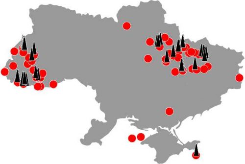
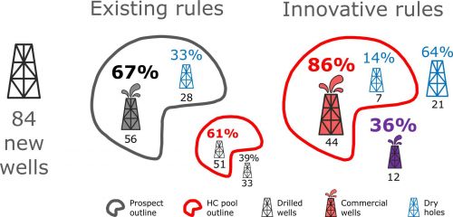
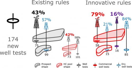
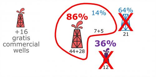
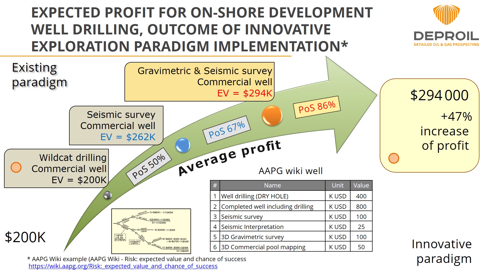
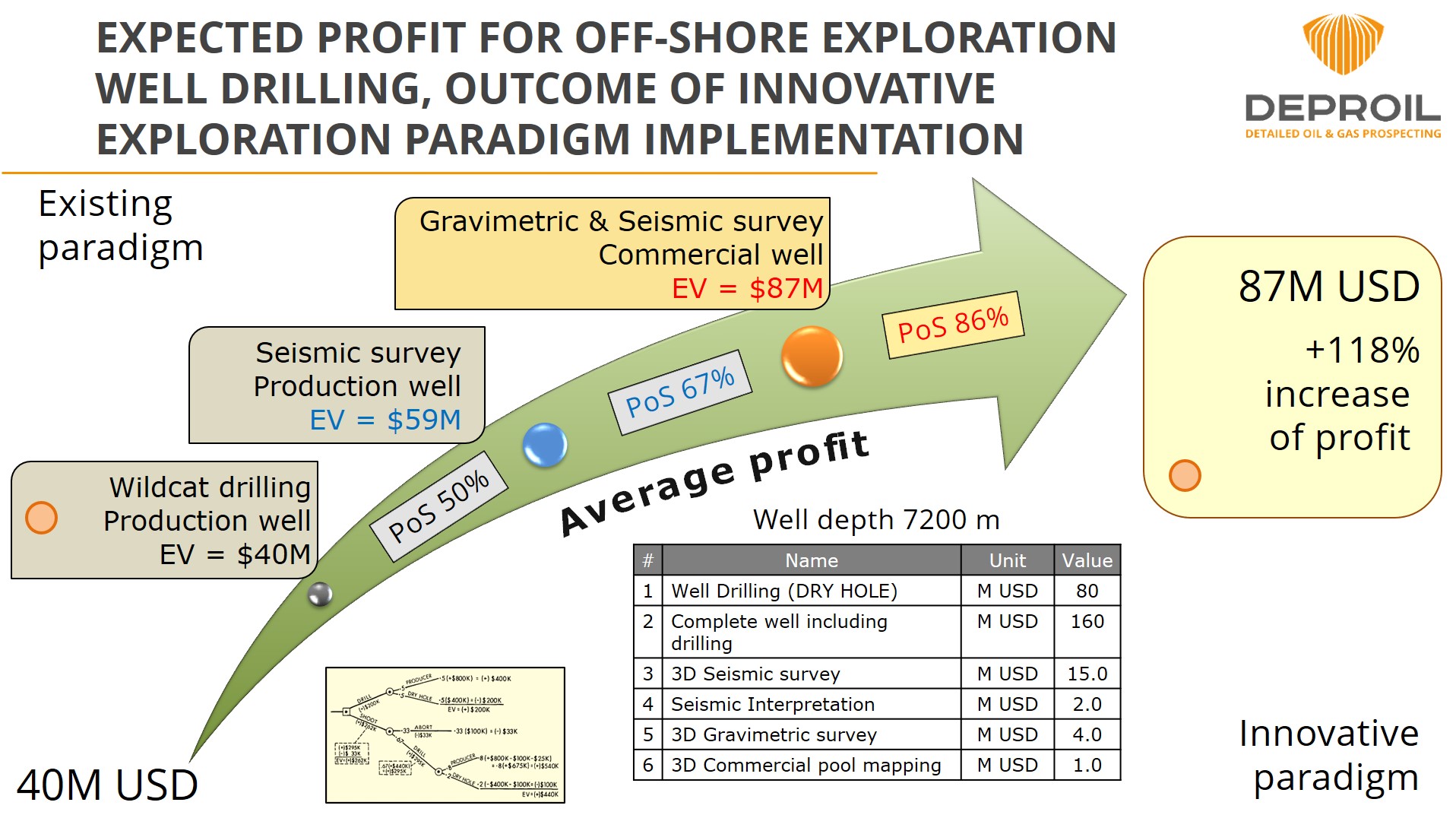
DEPROIL LTD proposed a new strategy for Ukrainian gas production, doubling it by implementing developed technology "Commercial hydrocarbon-bearing pools mapping of different morphology, origins and depth". » Read more
20/10/21
DEPROIL LTD proposed a new strategy for Ukrainian gas production, doubling it by implementing developed technology "Commercial hydrocarbon-bearing pools mapping of different morphology, origins and depth". » Read more
Entrypointgroup LLC & DEPROIL LTD have launched a joint subsurface intelligence capability
12/03/25
Entrypoint and Deproil have launched a joint subsurface intelligence capability designed to support investment decision-making in natural resource assets, including oil & gas, minerals, and energy-transition projects » Read more
12/03/25
Entrypoint and Deproil have launched a joint subsurface intelligence capability designed to support investment decision-making in natural resource assets, including oil & gas, minerals, and energy-transition projects » Read more
© Scientific and Technic Company "DEPROIL LTD", 2026. All rights reserved.